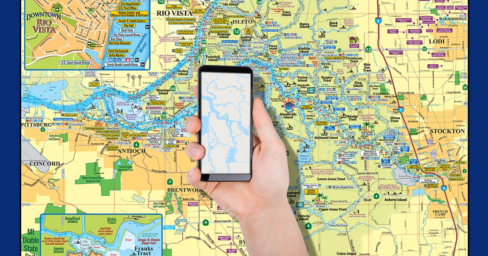
Why Buy a Delta Map when you already have a Smartphone Map App?
A question I am often asked!
There is an excellent argument for that question! There’s just nothing like a nautical chart, especially in an area as unique as the California Delta!
Does your phone display the depths? Crucial to boating in the Delta. Its very different than boating on a lake, a majority is only 5ft deep, for some boats low tide depth info is a make it or ground it situation.
Does your phone give you the channel marker numbers? Another crucial bit of info that will help you get a baring as to where you are… much of the Delta all looks the same, hence why many get lost.
Does your phone provide all the caution areas and sandbars, super crucial to saving your boat from damage and preventing injury.
Does your phone tell you where all the hot fishing areas are and what fish you can expect to catch there? Both shore and by boat hot spots are included.
Does your phone tell you where the awesome and SAFE places to Kayak are?
Does your phone float if you drop it in the water? Hard to see your map when its at the bottom of the river :)
Does your phone tell you at a quick glance which restaurants are on the water with guest docks? Great when you get hungry.
Does your phone tell you at a quick glance where you can get boat fuel? Another life savor bit of info when it's needed.
The California Delta Map is printed on non-rip, waterproof synthetic paper! No more ripped maps in the wind, a map that lasts a life time AND if it fly’s out of the boat… it WILL float :)