Delta Map Poster
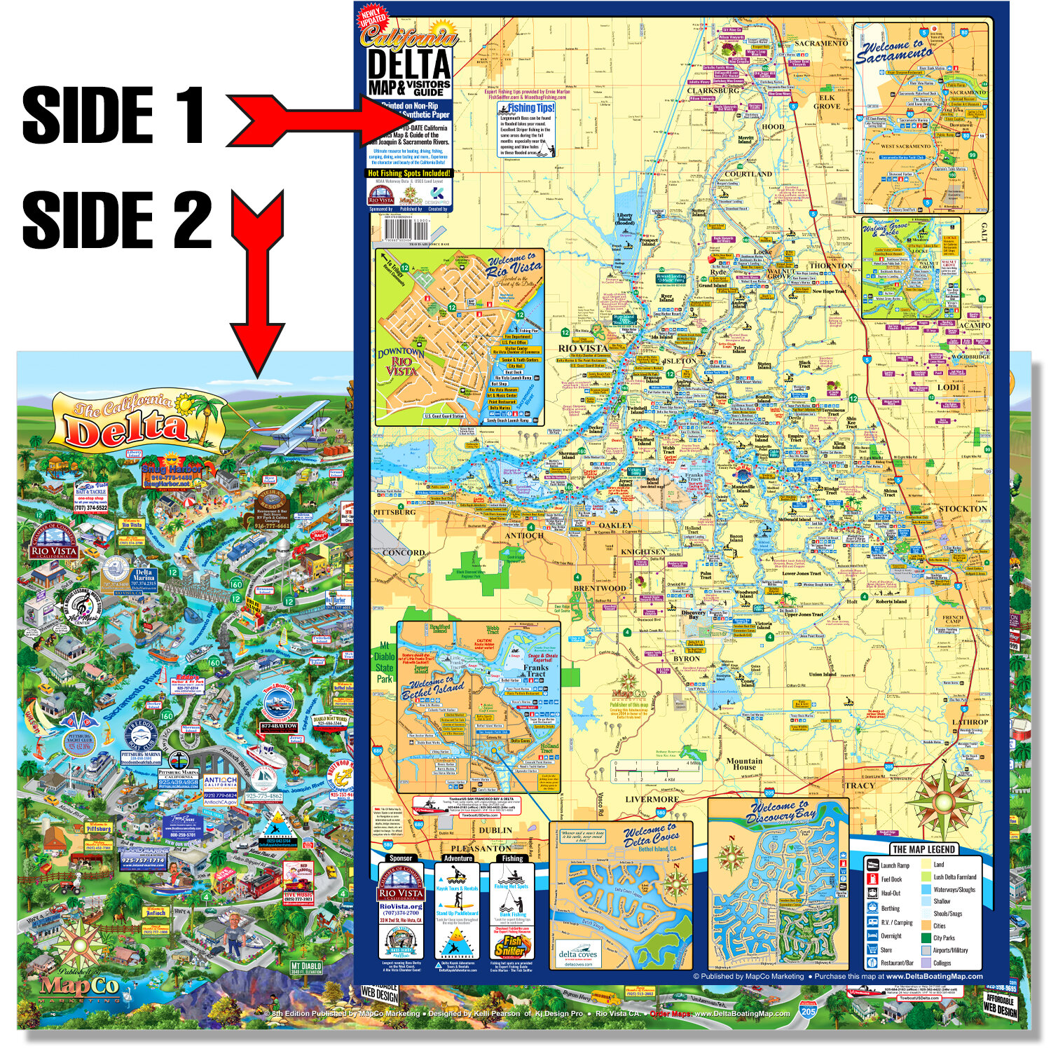
Delta Map Poster
ALL NEW UPDATED!
Poster size 24" x 36" Standard Frame Size - Printed on thick quality poster paper. Great for hanging on the wall or or your yacht or boat charting table!
NOTE: This map will be shipped in a 24” x 3” poster tube, some PO Box’s may not accept poster tubes.
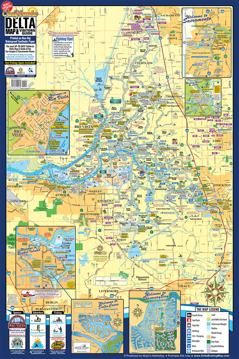
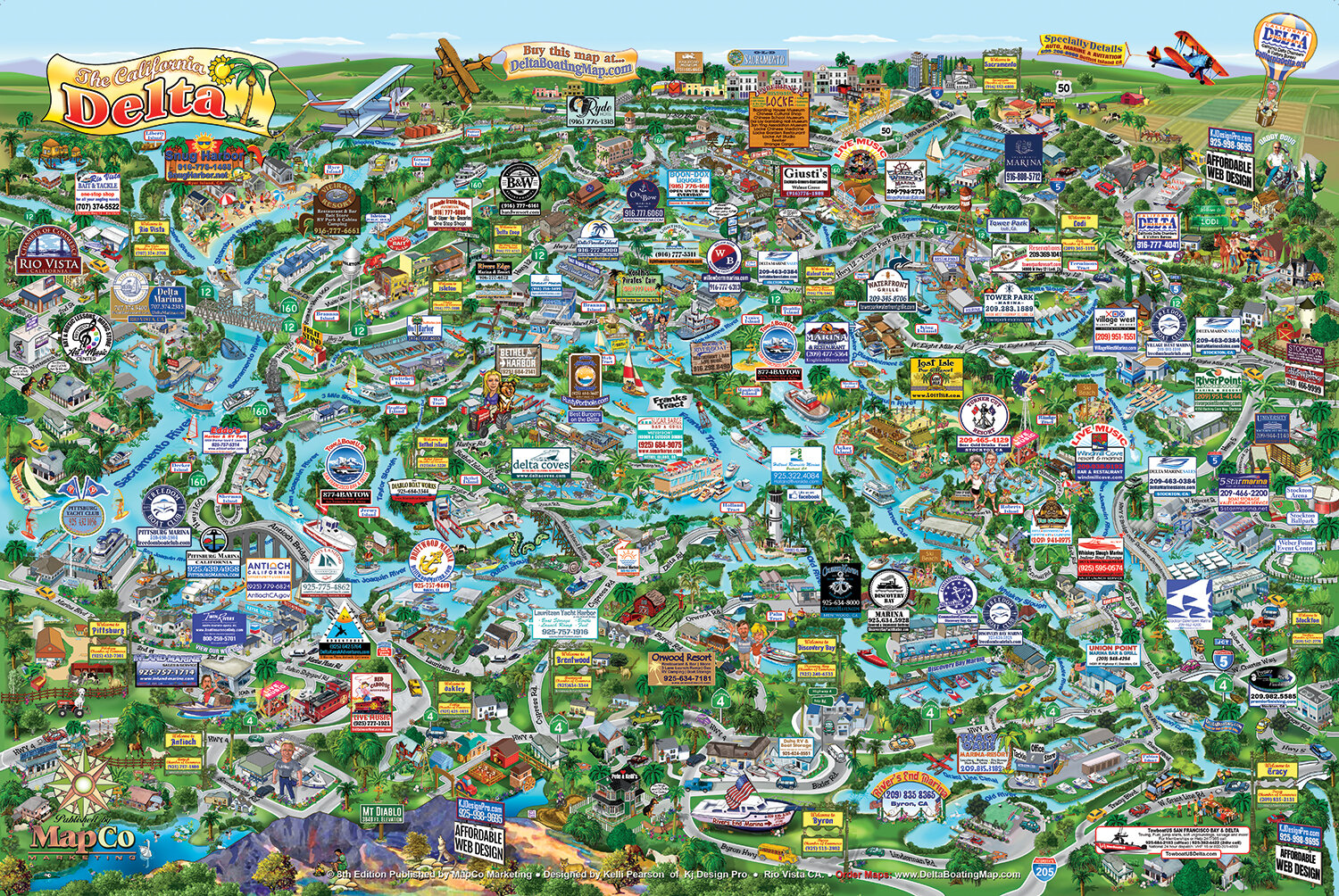
The Navigation map clearly displays:
Names of the Rivers & Sloughs
Depths - Low Tide Depths Displayed
Fishing tips and locations from the experts at the Fish Sniffer publication
Types of Fish and where they are most commonly found.
Bait Shops, locations and Contact Info
Anchorage Area
Boat Launching Areas
Delta Bridge Information - Great if you have a big & tall boat!
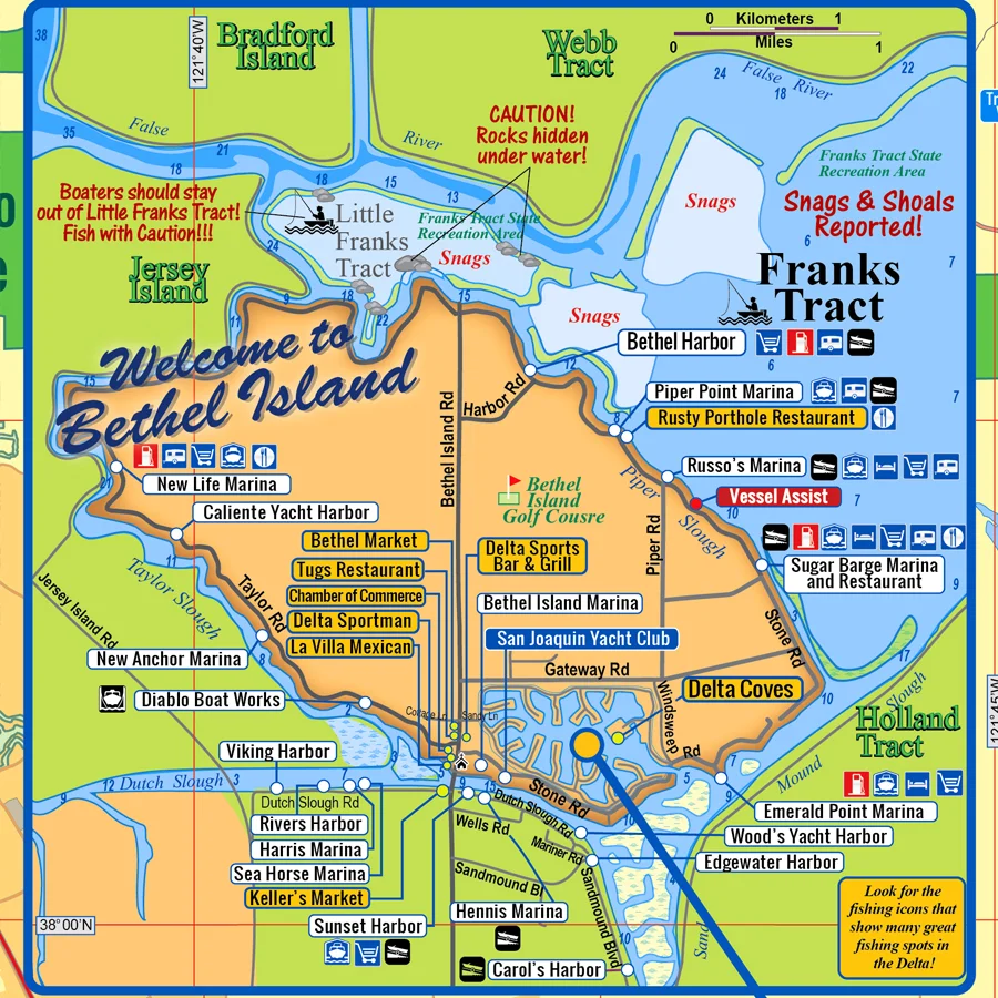
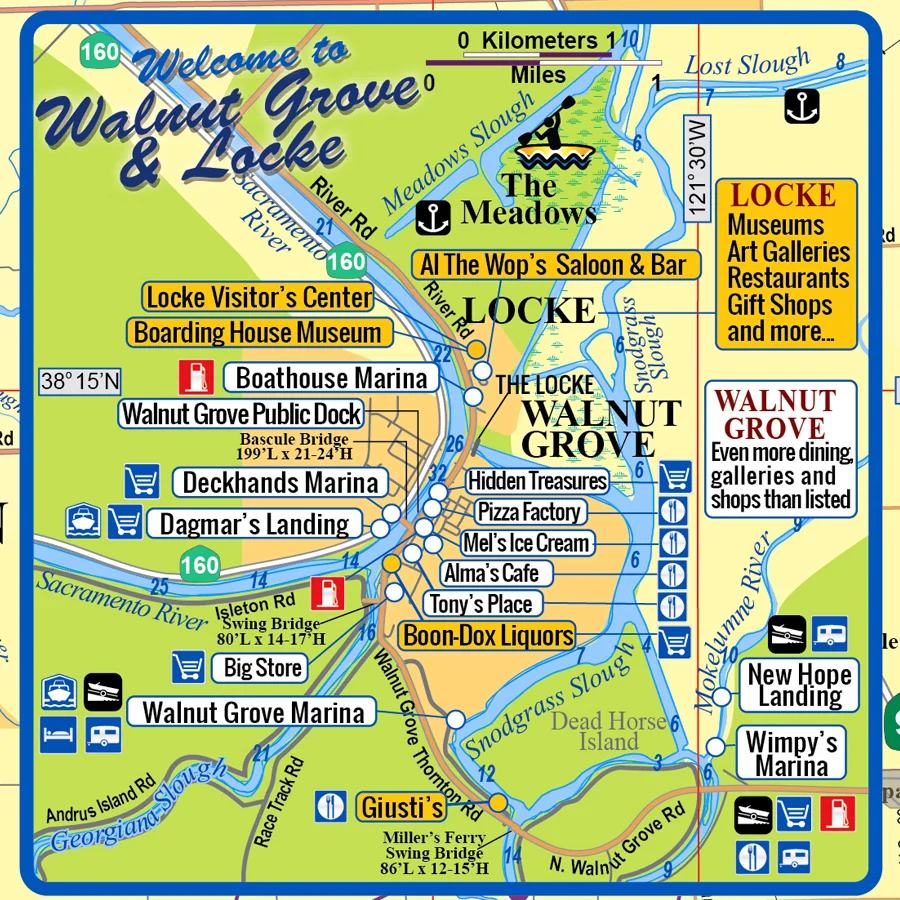
Detail Maps of: Rio Vista, Sacramento, Walnut Grove & Locke, Bethel Island, Delta Coves and Discovery Bay
Snags and Shallow Areas
Channel marker numbers
Marina Restaurants and Resort Names, Location and Phone Numbers!
Close-Up Detail of Sacramento, Discovery Bay and Bethel Island
Parks - Camping, RV and Boating
All wineries are listed in the entire Delta Region
Great Places to Windsurf
Boat Repair
and much much more...
About the Map
The California Delta Navigation & Caricature Visitor Guide has become the top selling map in the greater California Delta area. This Delta Map has JUST been freshly updated!
The Cartoon Visitors Guide side of the map is mesmerizing, fun and colorful and illustrates many of the popular places to visit. All of these Delta business support this product and may of them are Delta Map re-sellers located throughout the entire delta! See our list of locations here: Maps for Sale Throughout the Delta